Three Zones, One Park: The Complete Diver's Guide to Tun Sakaran Marine Park
From the flooded volcanic crater of the inner park to the pelagic corridors of the continental shelf — the Coral Triangle's most ecologically layered dive destination.
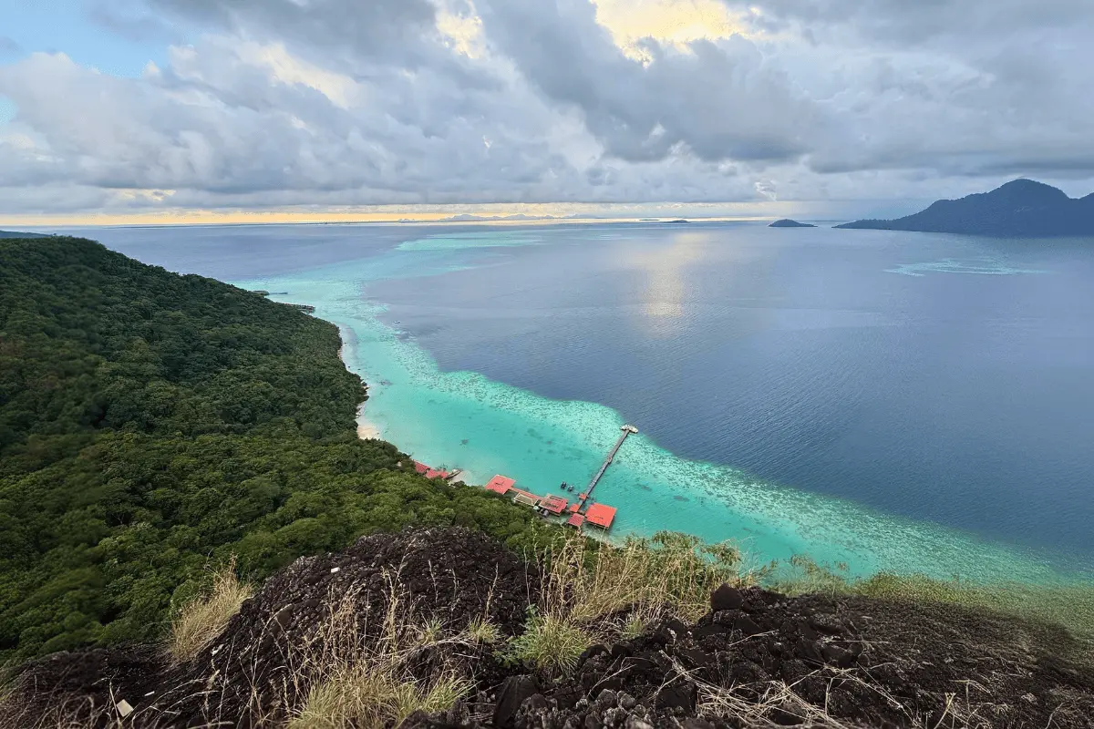
Tun Sakaran Marine Park sits at the entrance to Darvel Bay in the Celebes Sea, positioned at the heart of the Coral Triangle. Its documented biodiversity stands on its own: 528 species of reef fish, 240 species of marine invertebrates, 70 species of soft coral, and a global record of 44 mushroom coral species within a single park boundary. What those numbers cannot convey is the geological character that defines the experience here. Three of the park's eight main islands are the surviving rim of an ancient volcanic crater. The sea that flooded the caldera after its collapse left a sheltered lagoon 25 metres deep, and inside that lagoon, an unusual reef morphology — dense polygonal networks of coral walls growing directly from the sandy seabed — that exists in its largest form almost nowhere else on Earth. Tun Sakaran is not a single diving environment. It is three, each with its own topography and logic.
At a Glance
| Best time to visit | March to May (peak); April, July-September also excellent |
| Wet season | Diving continues year-round; visibility 5-15m November-February |
| Water temperature | 27°C - 30°C year-round |
| Skill level | All levels in the inner park; Advanced OW for outer channels and deep walls |
| Getting there | Fly to Tawau (TWU, ~90 min by road) or Kota Kinabalu (BKI, ~4 hrs by road) |
Three Zones, One Park
The park divides naturally into three distinct zones. The inner volcanic islands — Bodgaya, Boheydulang, and Tetagan — form the caldera rim of the ancient crater and enclose the sheltered lagoon. South and southeast, the limestone platforms and sandy cays of Sebangkat, Selakan, Sibuan, and Mantabuan span from world-class muck diving to sheer vertical walls and rare black coral gardens. Further northeast, beyond the park's formal boundary but connected to it ecologically and served by the same operators, the private island resorts of Mataking and Pom Pom sit on the outer continental shelf — a fundamentally different marine environment, defined by deep pelagic channels and open-ocean currents.
The Inner Park: A Flooded Volcanic Crater
Bodgaya, Boheydulang, and Tetagan are the surviving rim of an extinct volcano. When the crater collapsed and the Celebes Sea moved in, it left a 25-metre-deep lagoon of extraordinary shelter: glassy water, no open-ocean surge, and a topography found almost nowhere else in the region.
Inside the lagoon, the seafloor rises into what marine scientists call mesh reefs — dense, polygonal networks of coral walls standing four to seven metres tall and four to five metres wide, growing directly from the sandy seabed like the walls of a submerged city. Descending into them for the first time, open water disappears and is replaced by a labyrinth of coral corridors sheltering an unusual density of juvenile marine life, nudibranchs, and crustaceans. The largest versions of these formations — with individual reef cells up to one kilometre in diameter — extend across the Selakan Bank to the south.
The outer seaward faces of Bodgaya and Boheydulang offer a sharp contrast: steep volcanic slopes dropping abruptly to sandy plains at 15 to 17 metres, adorned with hard corals, gorgonian fans, and abundant nudibranchs. Tetagan, uninhabited and used as a traditional Bajau Laut burial ground, is the most sheltered of the three. Its rocky volcanic recesses reward patient, unhurried macro diving.
The Southern Islands
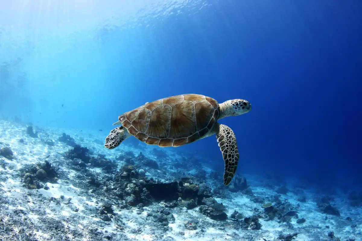
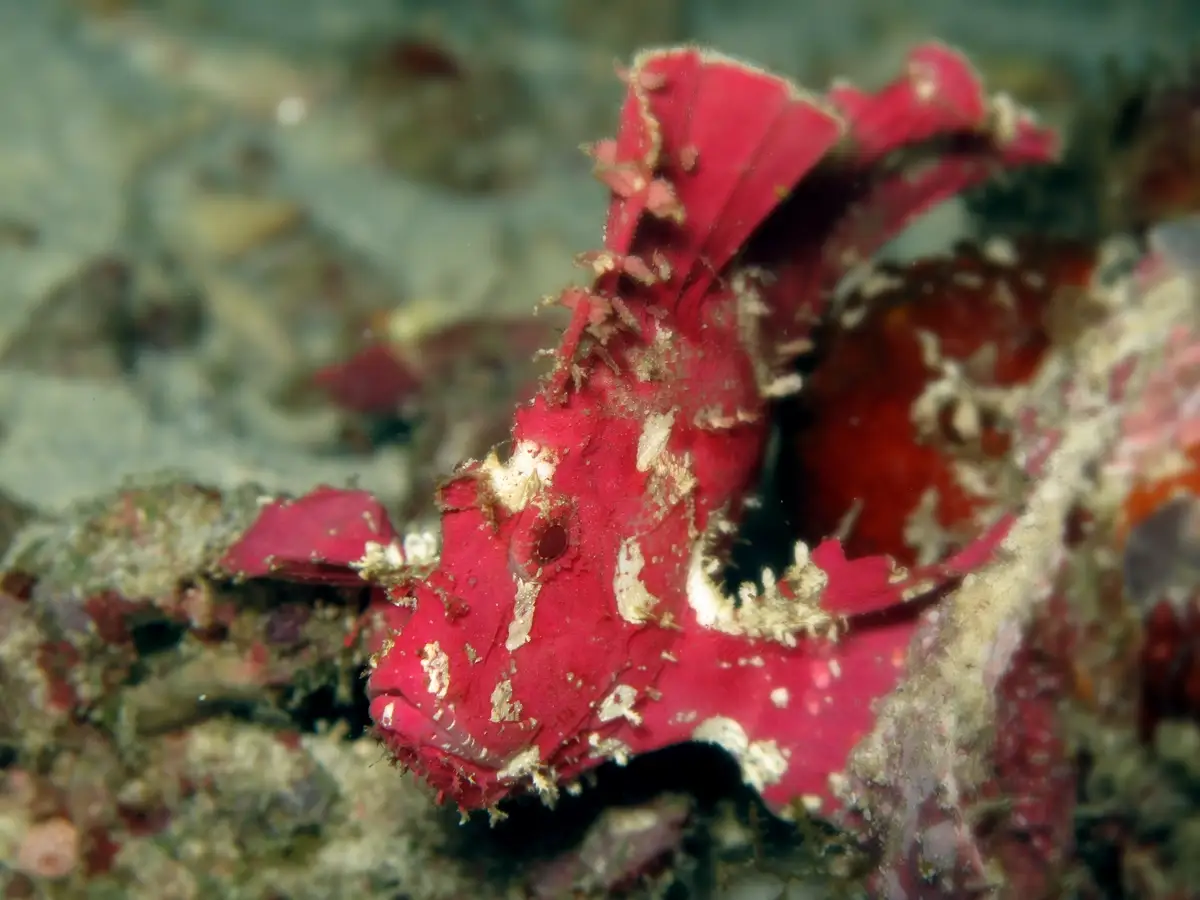
Sebangkat and Selakan sit on a shared limestone reef complex to the south. Sebangkat's silty, sandy substrate — a product of its high-sedimentation position — creates the conditions that camouflaged macro life thrives in: ghost pipefish, frogfish, and juvenile invertebrates that favour unstable environments over clean coral. Selakan holds the park's most extensive seagrass meadows — at least six species — which function as biological filters and reliable foraging grounds for green sea turtles.
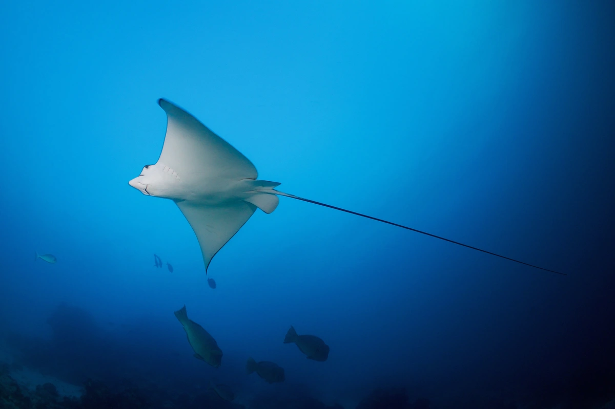
Sibuan makes the park's topographic variety concrete in a single island. Off the western beach, a gradual sandy slope descends into prime muck diving territory at 30 metres — pygmy seahorses, walking frogfish, seamoths, blue-ringed octopuses, and crocodile fish. The calm, shallow conditions on this side also make it the park's most accessible site for snorkellers and beginner divers. Swim around to the north of the same island and the seabed drops away as a sheer vertical wall, where hawksbill turtles and eagle rays move through the open water beyond the edge.
Mantabuan, the smallest island in the park, is disproportionately rewarding. The outer slope descends gently to seven metres before dropping steeply to a sandy plain at 15. Named sites here include Stingray Alley for eagle ray, devil ray, and manta encounters; Star Point for open-water pelagics; and between 22 and 35 metres, a rare Black Coral Garden of Antipathes species found under conditions that marine biologists consider exceptional for this latitude. Crinoids and painted lobsters line the outer reef slope in unusual density.
Connected to the Sibuan reef, the shallow patch reef of Church Reef — known locally as Tabah Siramba — is the park's most approachable site for snorkellers and relaxed diving. Crystal-clear water, slight and manageable currents, and resident populations of pygmy seahorses, mandarinfish, and ribbon eels make it equally rewarding for divers who prefer depth under 15 metres.
The Outer Islands: Continental Shelf
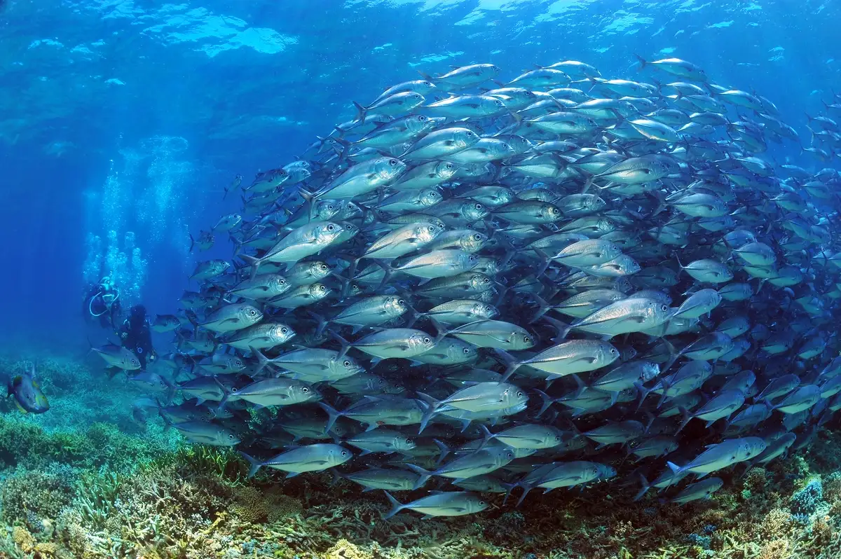
A 30 to 45-minute speedboat ride northeast of the inner park places you at a fundamentally different type of diving. Mataking — the closest Malaysian island to the Philippine border — sits on the edge of the continental shelf, and that position defines everything about it. The deep-water Alice Channel runs between Mataking and the Sipadan dive corridor to the southwest, functioning as a pelagic expressway. Complex current patterns carry manta rays, hammerhead sharks, grey reef sharks, and seasonal whale sharks — most reliably between March and May — into the reefs surrounding the island. Divers seeking the pelagic encounters that the Sipadan area is known for can access comparable marine life through Mataking without the permit restrictions that cap daily visitor numbers at Sipadan. North Point, the channel's most demanding site, descends a vertical wall to a cleaning station at 37 metres where mantas and hammerheads gather with the reliability of scheduled arrivals. Advanced certification and comfort in strong current are genuine requirements here.
Mataking's shallower sites cover the full range: Turtle Playground for reliable green sea turtle encounters, Nudibranch Heaven for macro variety including ribbon eels and banded pipefish, Hump Head Point for bumphead parrotfish grazing on healthy shallow corals, and The ShipWreck — a 40-foot wooden cargo vessel purposefully sunk in 2006 between 12 and 27 metres — which houses Malaysia's only underwater post office, where divers can post waterproof postcards to the surface world.
Pom Pom, roughly 45 minutes from Semporna, operates as the area's premier muck diving destination. Its fringing reef is narrow on the western side and broader elsewhere, with deep vertical walls starting at 27 to 30 metres on the northern and eastern edges. Mandarin Heaven, accessible by giant stride from the resort jetty, offers mandarin fish sightings at five metres alongside ghostpipefish and zebra lionfish sheltering in the shallows. Pit Rock, on a gradual rubble slope near 20 metres, suits all certification levels and reliably produces schools of glassfish, leaf scorpionfish, and peacock mantis shrimp. Northern Valley drops past 40 metres with strong current — gorgonian fans at 27 metres host pygmy seahorses, but this is an experienced-diver site. At Spongebob, active coral restoration managed by the Tropical Research and Conservation Centre (TRACC) has transformed a bombed-out rubble field into a diver-accessible recovery zone; planted coral frames and artificial reef structures are being actively reclaimed by marine life. Pom Pom is also a significant nesting site for green and hawksbill turtles, making in-water encounters close to guaranteed.
The Bajau Laut
The Bajau Laut — the sea nomads of the Semporna archipelago — have been free-diving these waters for centuries, reaching depths that require decompression stops for most certified divers. Their houseboats and stilt villages are a living presence across Maiga, Kalapuan, Bohayan, and the surrounding islands; their relationship with this sea predates the marine park itself by generations. The stilt communities visible across the inner park are not staged for visitors — they are home.
Choosing operators who employ Bajau Laut crew members or guides is the most direct way to ensure that diving here returns something to the communities whose presence defines this landscape. When visiting Maiga's clear-water reefs and sandy shores, approach the community with the same respect you would extend to any private home: photograph individuals only with their clear consent, and avoid engaging with vendors who appear to be staging encounters for tourist income. Tetagan's traditional burial ground is sacred and should not be approached.
Conservation
Diving in Tun Sakaran directly funds the Giant Clam and Marine Invertebrate Hatchery at Boheydulang, which breeds endangered species including the Fluted Giant Clam (Tridacna squamosa) and the rare China Clam (Hippopus porcellanus). At Pom Pom, TRACC's restoration programme is diver-accessible at the Spongebob site. The park's 44 documented species of mushroom coral — a global record for the Coral Triangle, including rare species like Lithophyllon ranjithi and Halomitra clavator — are found across reef profiles that reward careful buoyancy and a strict no-touch approach. The black coral gardens along the outer reef slopes at 22 to 27 metres exist under conditions that remain poorly understood. Both are worth treating accordingly.
When to Visit
March to May is the peak period: visibility frequently reaches 40 metres, seas are at their calmest, and whale sharks appear seasonally in the channels around Mataking. April, July, August, and September are also excellent, with consistent surface conditions and strong underwater visibility.
The wet season runs from November to February and brings occasional short tropical showers and reduced visibility of five to 15 metres. Dive operations continue year-round. Sabah sits below the East Asian typhoon belt — it is known as the Land Below the Wind for good reason — and does not suffer the prolonged, disruptive monsoons that force other Malaysian island destinations to close for months. The cooler, nutrient-rich currents that move through during the wet season sustain the soft coral growth and black coral gardens that define the deeper outer reef profiles.
Water temperature stays between 27°C and 30°C year-round.
Getting There
Two airports serve the Semporna area. Tawau Airport (TWU) is the closer option, approximately 90 minutes by road. Kota Kinabalu International Airport (BKI) is around four hours by road but connects to more international routes, including direct services from Kuala Lumpur and Singapore. From Semporna's main jetty, the crossing to the inner park islands takes approximately 45 minutes; Mataking and Pom Pom are a further 30 to 45 minutes by fast boat.
Planning Your Trip
The inner park islands and the outer continental shelf islands are served by different resorts. A resort stay in the inner park puts the lagoon mesh reefs, Mantabuan's ray-filled outer wall, and Church Reef within straightforward daily reach, with day trips available to the outer islands. Mataking and Pom Pom are both private island resorts — the resorts we work with here span the inner park, Mataking, and Pom Pom, and the choice between them largely depends on whether pelagic or macro diving is the priority.